 A "Focused Look" Project Overview
Significant fish and wildlife habitat is a Goal 5 natural resource. Oregon has a detailed process for counties and cities to follow when changing natural resource standards.
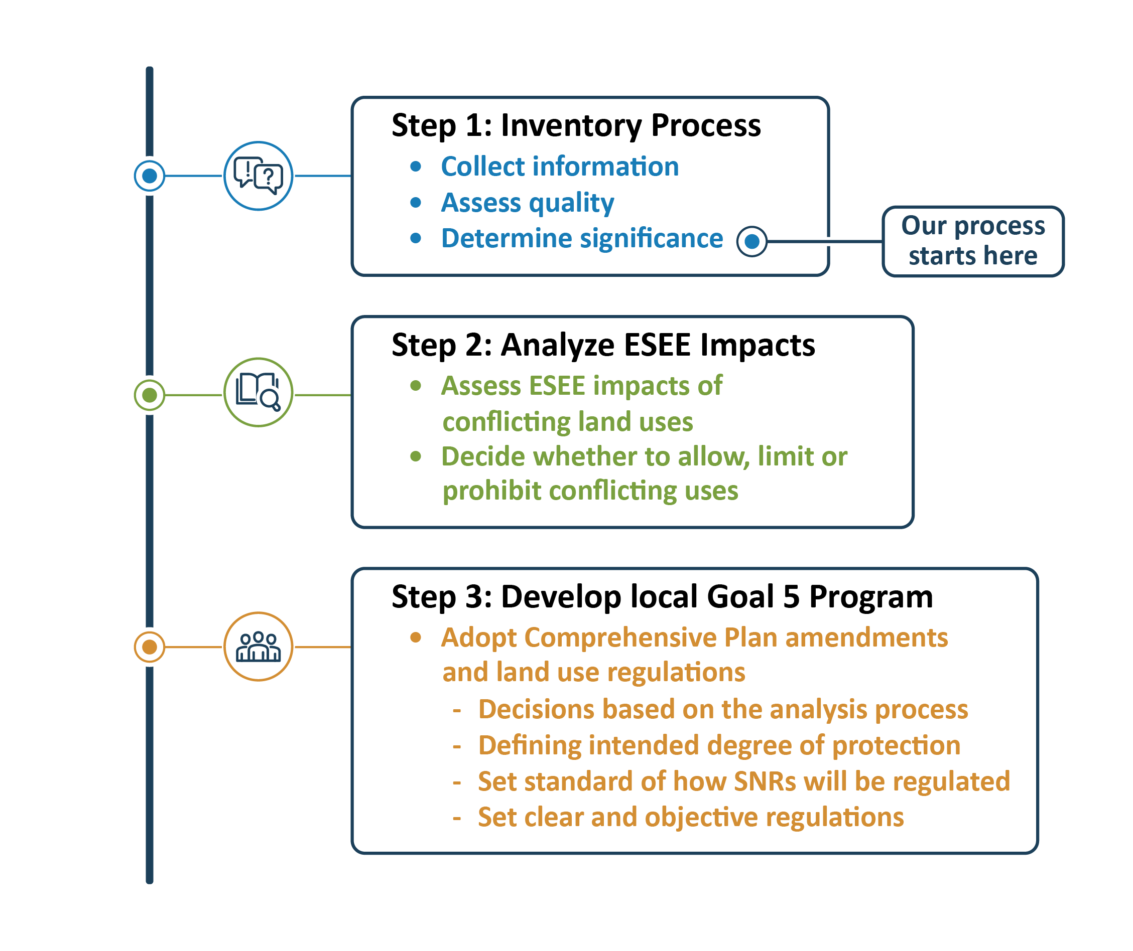
Step 1: Inventory. Our inventory process began with consolidating Washington County and Metro natural resource inventory maps. We then adjusted this consolidated map to show the natural resources that remain significant. Next, we did a manual review and data cleanup. Finally, we added data that was acquired in more recent planning studies for areas added to the Urban Growth Boundary after the County’s original Inventory was created.
Step 2: ESEE Analysis. We’ll then identify different land uses that could conflict with the significant natural resources and conduct an Economic, Social, Environmental, and Energy (ESEE) Analysis. This includes a study of the impacts of allowing, limiting or prohibiting land uses that could conflict with the mapped significant natural resource area.
Step 3: Develop local Goal 5 Program
The project will result in updates to our Goal 5 program and apply appropriate protections to County significant natural resources through plan policies and code standards.
Statewide Planning Goal 5 (Natural Resources, Scenic and Historic Areas, and Open Spaces) is a broad statewide planning goal covering many resources, including significant fish and wildlife habitats.
Natural resources identified under Statewide Planning Goal 5 promote a healthy environment and a natural landscape that contributes to Oregon’s livability. Goal 5 requires cities and counties to adopt programs to protect these resources for present and future generations. In Washington County, Goal 5 resources are called Significant Natural Resources (SNRs).
The first step in protecting SNRs is completing the inventory process. An “inventory” is a map identifying the general location and type of resources. The information must be sufficient to determine whether a resource exists on a site. However, a precise location of the resource for a site, as required for building permits, is not necessary at this stage.
We’re not starting with a blank slate. The draft map uses habitat resource inventories previously prepared by both Washington County and Metro to help decide which habitat resources are significant.
We do have a Significant Natural Resource inventory. Our program includes work completed in the 1980s that was updated in the mid-2000s under Metro.
The 1980s SNR inventory identifies locally significant fish and wildlife habitats in unincorporated Washington County. See our Urban Community Plan and Rural Natural Resource Plan maps. The current County regulations that protect, preserve or mitigate impacts are in Community Development Code Section 422.
In addition, some natural resources are also regulated by other agencies such as Clean Water Services and the Oregon Department of State Lands. This project will not impact those regulations.
We began reviewing our natural resource program in 2020 to address out-of-date natural resources inventory and regulations that weren’t clear and objective.
We adopted changes to our regulations, but these were legally challenged and did not go into effect. The legal decision gave us a roadmap to follow when developing new regulations. We must
We plan to have new regulations adopted by Oct. 1, 2024.
The process takes time! While this effort is underway, an enforcement order and halt on development in wildlife habitat areas is in place until the effective date of our new regulations. Learn more about the enforcement order.
When the natural resources program update is complete, there will be:
Place where a plant or animal species naturally lives and grows, providing for food, shelter and reproductive needs
Rivers, streams, wetlands, undeveloped floodplains, forest canopy and adjacent areas. These provide important habitat for fish and wildlife as well as other water quality functions
Vegetated areas beyond the riparian habitat, including larger forest patches that are considered of high value, that provide habitat for wildlife. May include areas that enhance the Riparian Habitat value or are unique or unusually important wildlife habitats based on site specific information from the original inventory
Vegetated areas beyond the riparian habitat that are considered of moderate value, including medium-sized forest patches, that provide wildlife habitat. These are different from Upland Wildlife Habitat Class A by being further from water areas or providing lesser- quality habitat
Areas identified through the County’s process in the 1980s as sensitive habitats, and forested areas near water areas and wetlands